Lêer:Mapa del Virreinato de la Nueva España (1819).svg

Size of this PNG preview of this SVG file: 799 × 599 piksels. Ander resolusies: 320 × 240 piksels | 640 × 480 piksels | 1 024 × 768 piksels | 1 280 × 960 piksels | 2 560 × 1 921 piksels | 885 × 664 piksels.
Oorspronklike lêer (SVG-lêer, normaalweg 885 × 664 piksels, lêergrootte: 1,06 MG)
Opsomming
| Beskrywing |
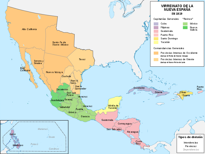
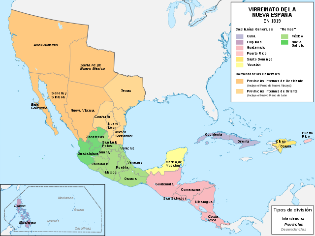
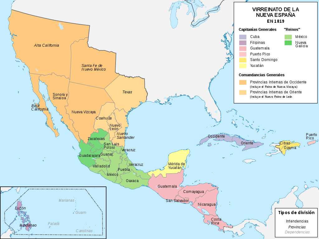
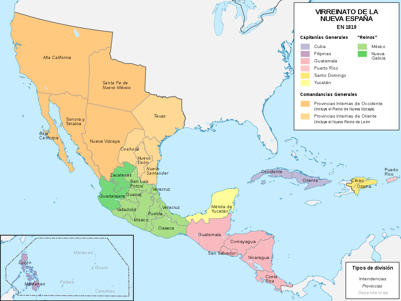
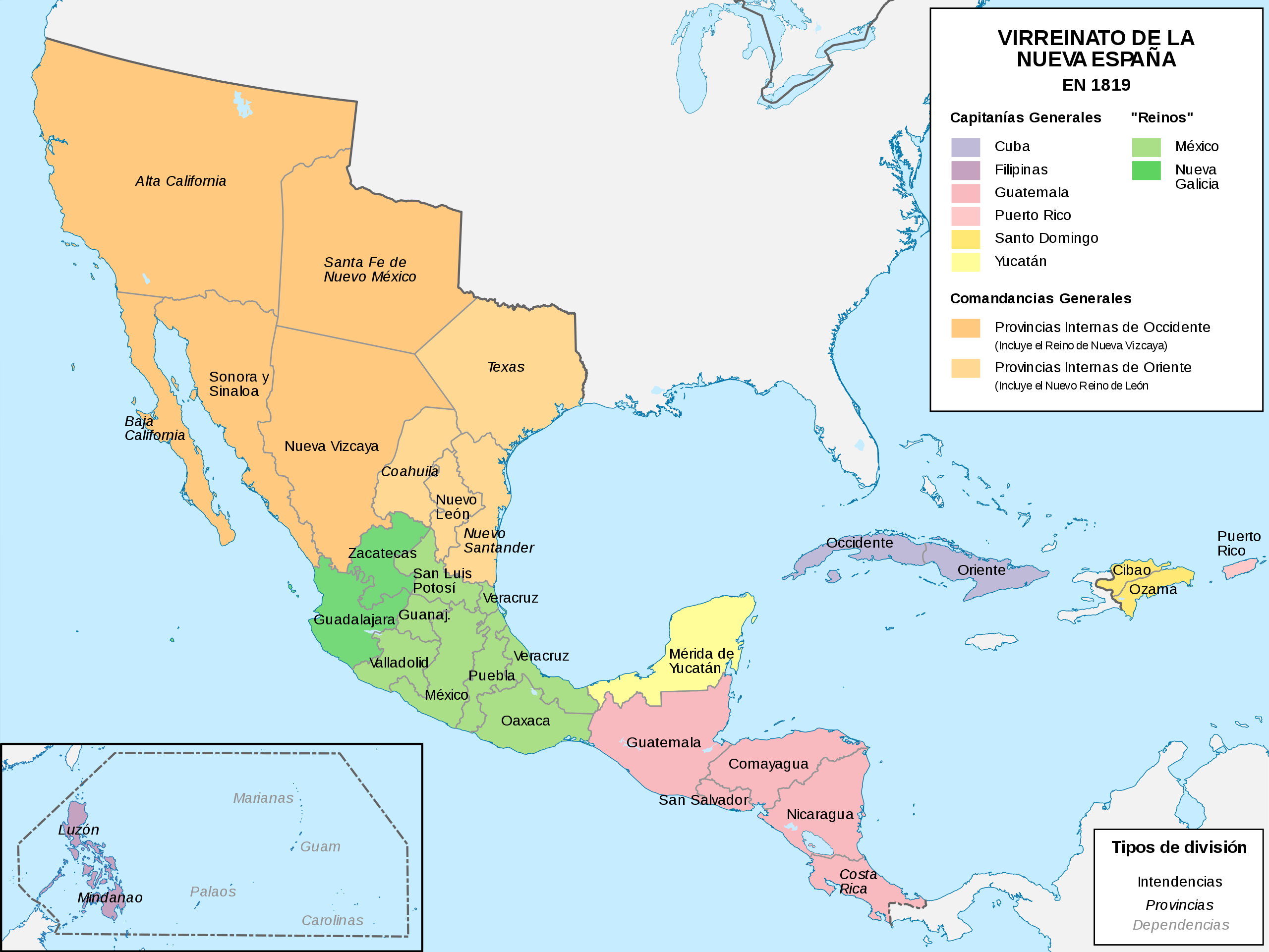
Español: Mapa político del Virreinato de la Nueva España (1819) |
| Datum | |
| Bron |
Eie werk |
| Outeur | Milenioscuro |
| Ander weergawes |
|
.svg)
.svg)
.svg)
.JPG)
Lisensiëring
Ek, die outeursreghouer van hierdie werk, publiseer dit onder die volgende lisensie:
This file is licensed under the Creative Commons Attribution-Share Alike 4.0 International license.
- U is vry:
- om te deel – die werk kopieer, versprei en deurgee
- om te hermeng – om die werk aan te pas
- Onder die volgende voorwaardes:
- naamsvermelding – U moet die nodige krediet gee, 'n skakel na die lisensie verskaf en aandui of daar veranderinge aangebring is. U mag dit op enige redelike manier doen, maar nie op enige manier wat daarop dui dat die lisensiegewer u of u gebruik onderskryf nie.
- insgelyks – As u die materiaal hermix, transformeer of voortbou, moet u u bydraes versprei onder die dieselfde of versoenbare lisensie as die oorspronklike.
Lêergeskiedenis
Klik op die datum/tyd om te sien hoe die lêer destyds gelyk het.
| Datum/Tyd | Duimnael | Dimensies | Gebruiker | Opmerking | |
|---|---|---|---|---|---|
| huidig | 10:58, 13 November 2018 | | 885 × 664 (1,06 MG) | Milenioscuro | User created page with UploadWizard |
Lêergebruik
Die volgende 2 bladsye gebruik dié lêer:
Globale lêergebruik
Die volgende ander wiki's gebruik hierdie lêer:
- Gebruik in ar.wiki.x.io
- Gebruik in ast.wiki.x.io
- Gebruik in azb.wiki.x.io
- Gebruik in be-tarask.wiki.x.io
- Gebruik in be.wiki.x.io
- Gebruik in br.wiki.x.io
- Gebruik in ca.wiki.x.io
- Gebruik in cs.wiki.x.io
- Gebruik in de.wiki.x.io
- Gebruik in en.wiki.x.io
- Gebruik in es.wiki.x.io
- Demografía de México
- Suroeste de Estados Unidos
- Reino de Nueva Vizcaya
- Mexicanos
- Comandancia General de las Provincias Internas
- Organización territorial del Virreinato de Nueva España
- Portal:Nueva España/La foto del mes
- Historia territorial del Estado de México
- Conflicto entre Guatemala y México de 1842 y 1882
- Virreinato de Nueva España
- Regionalización de la Nueva España y división territorial de México
- Texas (Nueva España)
- Anexo:Gobernantes de las Californias
- Guerras indias de Texas
- Mexicanos blancos
- Gebruik in eu.wiki.x.io
Wys meer globale gebruik van die lêer.
.svg)
.svg)